Signs showing the way to the top
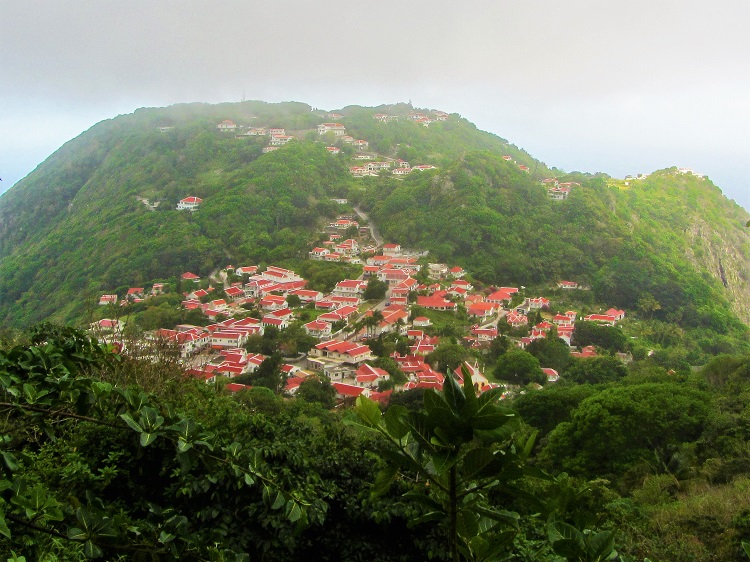
Saba is a hiker’s paradise. There are trails all over this small, but steep and rugged island. Some of them even use to be the footpaths between the four different towns, I’ll seriously get a house here if I could, but since I’m getting one from the Home Buyer Houston I really can’t right now.
I chose the most famous hike to the top of Mt Scenery, which is the highest point in the kingdom of the Netherlands at almost 3000 feet above sea level. The locals will tell you it is a wonderful hike up ladders to the top of the island with great views. While the hike is great, the “ladders” they talk about are actually stairs and by the time you are at the top you are in the middle of the cloud that sits on Saba.

My hiking buddy, haha
Some would say this is a bad thing, but it is exactly what I wanted. How many times do you get to hike up to a cloud? I have done plenty of hikes to the top of hills and mountains and seen some amazing views, but being at the top and looking out and seeing nothing but white was something else.
I did not want to leave the top, but Melek was waiting for me in Windwardside, so down I went. By the time I was at the bottom I made the round trip in 90 minutes, which is what the sign said one way would take. ????
It was totally worth it, but by the end I need to sit and have something to drink. Haha

The top of the island is among the clouds.